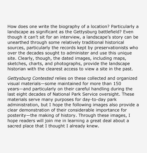
At the time of the battle, most of Pennsylvania was rural, with a few industrial towns and cities sprinkled throughout the commonwealth. Running as a swath through the southern segment of the state, paths and roads formed trade corridors that had radiated from Philadelphia since the state’s earliest days. Bound largely to nearby York and Harrisburg by these trade routes, Gettysburg’s farmers dispersed their products. The road network made Gettysburg unique from other communities and also brought the men and materiel for battle. While the passageways were in no way smooth, they did make Gettysburg a uniquely accessible community. This view of Gettysburg is looking south on Baltimore Street after the battle, ca. 1863–1870s. Photograph by Charles and Isaac Tyson. Source: Gettysburg National Military Park Archives.
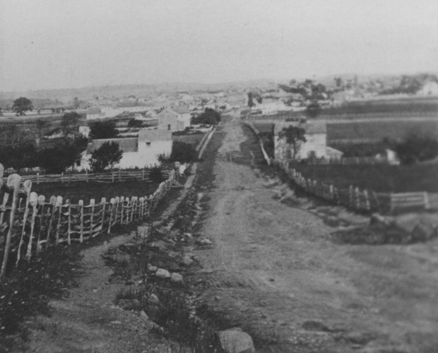
A source of pride before the battle, Ever Green Cemetery (established in 1854) had only recently opened on the significant swell of land that lay south of the town of Gettysburg’s boundary. The cemetery’s grand gatehouse was marked by a brick building that doubled as a home to its caretakers, the first of whom were PeterThorn, who became the superintendent of the cemetery in 1856, and his wife, Elizabeth. After Peter joined Company B of the 138th Pennsylvania infantry, Elizabeth served as caretaker from 1862–1865. Once Cemetery Hill became the center of the Union line, it also became the focus of intense fighting, and Elizabeth abandoned the gatehouse, which was then used as a headquarters by Union leaders. In the weeks following the battle, Elizabeth, while six months pregnant, and her father dug graves and buried ninety-nine soldiers in the rockiest portions of the cemetery. In this photograph by Alexander Gardner on July 7, 1863, the earthen fortifications remain but the building’s windows do not. Source: Gettysburg National Military Park Archives.
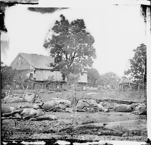
The Trostle Farm held one of the area’s largest barns, which is shown in this 1863 photograph taken soon after the battle. The Pennsylvania bank barn pictured here is one of the most familiar agricultural structures of the Mid-Atlantic region, particularly during the mid-1800s. This remarkable example combines stone walls on both ends and the door built into the hillside on the reverse side, which cannot be seen here. In the foreground, this image presents the startling record of animal carnage as a result of the battle. Each horse carcass threatened to spread disease to the community by hosting overwhelming populations of vermin and attracting other animals. Since disposal of horse carcasses was very challenging, most were taken off the field and burned. Photographer unknown. Source: Gettysburg National Military Park Archives.
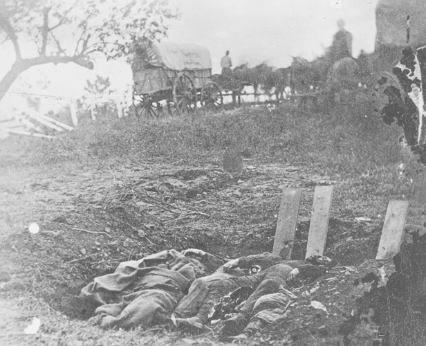
Our knowledge of initial burial practices on the battlefield has been pieced together from a variety of sources. Most importantly, a few early photographs— many of them now well-known iconic images of American history—capture steps in the process of temporary burials. Among these images, Alexander Gardner's of July 5,1863 mark the earliest and most poignant. This photo at the Rose Farm is the only one to demonstrate the burial practices of the initial internment on the battlefield. Mass, temporary graves were employed directly on the field so that corpses could be more rapidly protected by at least a few inches of earth. Planks were often used to identify those who could be named, but many went nameless. Most of these initial burials were exhumed and reburied within months in a permanent resting spot such as the Soldiers' National Cemetery. Source: Gettysburg National Military Park Archives.
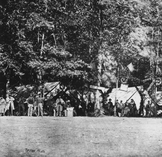
Field hospitals sprang up early in the days of fighting and remained long after the battle had ended. Often they were placed in converted structures, ranging from barns to the main classroom building at Pennsylvania (now Gettysburg) College. They were placed where they were needed; many, therefore, were located along the battlefield in the cover of forest outcroppings. Following the battle, when the landscape of battle became one of convalescence, the varied hospitals were condensed into one: Camp Lettermen. This July 1863 image by Charles and Isaac Tyson was taken from a Tipton stereo view. Source: Gettysburg National Military Park Archives.
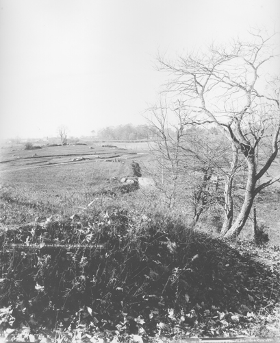
The Union earthworks of Brigadier General James Wadsworth’s First Division, I Corps, with tourism development already visible at Culp’s Hill in the distance. Photograph by William H. Tipton, ca. 1888–1889. Source: Gettysburg National Military Park Archives.
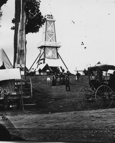
The concept of an overlook (a “bird’s-eye view”) was familiar to field generals and tourists alike. For this reason, entrepreneurs and preservationists added towers to many areas of the battlefield by the 1870s. One Tipton photo shows the observatory on East Cemetery Hill during the Grand Army of the Republic’s Encampment in 1880. Source: Gettysburg National Military Park Archives.
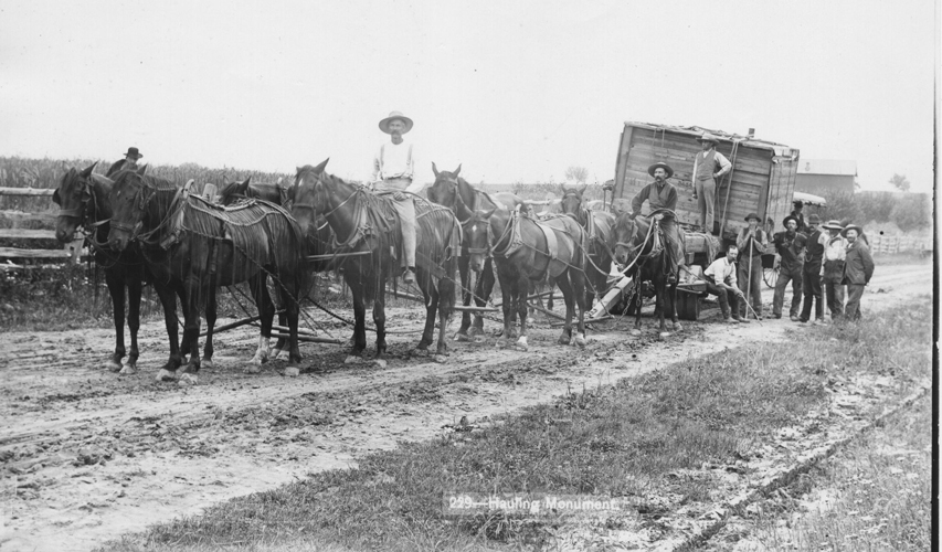
In this Tipton photo of 1883, a team and wagon are used to deliver one of the new monuments. Under the supervision of the Gettysburg Battlefield Memorial Association, most monuments were constructed by a select group of sculptors and then brought to the battlefield for completion and installation. Source: Gettysburg National Military Park Archives.
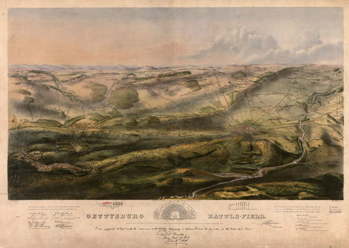
John B. Bachelder’s innovative Isometric Map of the Battle of Gettysburg (1863), based on his extensive knowledge, was his first depiction of the sequence of the battle’s events and the general locations of troops. It was also offered for sale in limited numbers, which made it one of the first tourist products memorializing the battle. Source: Gettysburg National Military Park Archives.
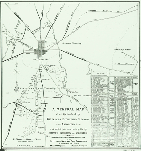
This map from the 1890s shows all of the lands owned by the Gettysburg Battlefield Memorial Association along with many of the properties it desired, all attributed with specific location names. Source: Gettysburg National Military Park Archives.
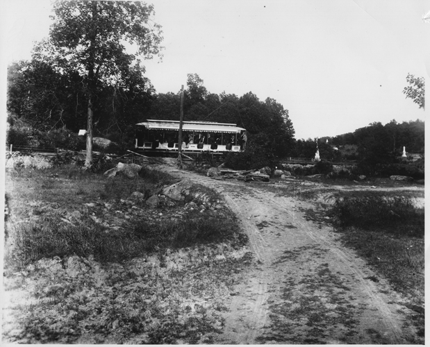
In this image (ca. 1890), the electric trolley arrives from the town of Gettysburg to the Devil’s Den area. Little Round Top (not pictured) is to the right of the white monuments (far right). Photographer unknown. Source: Gettysburg National Military Park Archives.
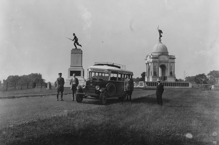
Buses allowed preservationists to maintain control of the field while still affording access to a maximum number of visitors. This image from the 1920s shows how large buses could easily manage the carefully designed roads around the Pennsylvania State Memorial (center right), which commemorates the 34,530 Pennsylvania soldiers who fought at Gettysburg. Completed in 1914, at 110 feet it remains the largest monument on the battlefield. The 72nd Pennsylvania Infantry Monument (center left) was dedicated on July 4, 1891, to honor the regiment that held back Confederate forces engaged in the Pickett-Pettigrew-Trimble assault at the Angle. Photographer unknown. Source: Gettysburg National Military Park Archives.
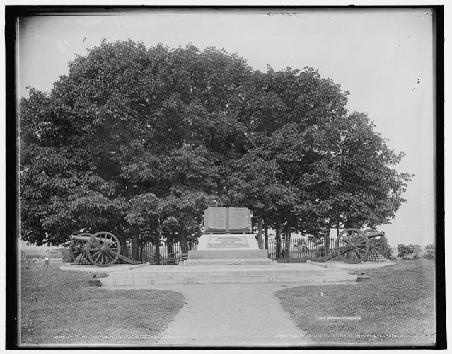
Since 1900, the commemorative Copse has been set aside with an iron fence. After interviewing Confederate veterans, John D. Bachelder decided that this group of trees was the goal of the Confederate surge on July 3, known as the High-Water Mark. In hopes of encouraging more Confederate participation at Gettysburg, he led the Gettysburg Battlefield Memorial Association to set the Copse aside from all other portions of the battlefield. Photographer unknown, 1903. Source: Gettysburg National Military Park Archives.
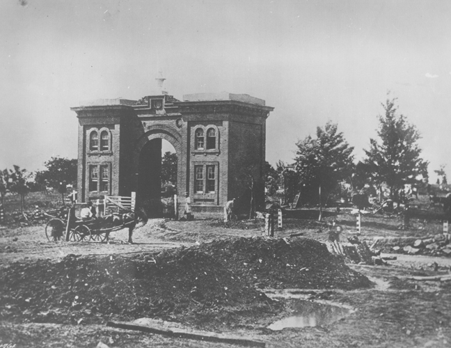
It was the Gettysburg National Tower’s looming presence—particularly over the most sacred portions of the battlefield such as Cemetery Hill and the site of the Gettysburg Address—that led the National Park Service to expand the concept of preservation to mitigate infringements on the view shed. Photographer unknown, ca. 1980. Source: Gettysburg National Military Park Archives.
Pilgrimage to Little Round Top on the 150th anniversary of the battle. Photograph by David Wharton, July 2, 2013.